at some of our work!
and support services designed to meet your unique needs
Our Work
At Gledaki Services Limited, we offer a comprehensive range of professional survey solutions tailored to meet the needs of diverse industries and projects. Backed by cutting-edge technology, a skilled team, and a commitment to precision, we provide accurate, reliable, and efficient data collection and analysis services to support planning, development, construction, and environmental monitoring. Let us take you through some of our projects here;
Aerial Mapping
Dongo Kundu Special Economic Zone (SEZ) Aerial Mapping
Client: Government of Kenya / SEZ Authority
Service Provided: Aerial Mapping and Geospatial Survey
Location: Mombasa County, Kenya
Executed by: Gledaki Services Limited
Hydrographic/bathmetric Survey
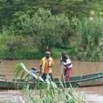
Gogo Dam –Hydrographic/bathmetric Survey
Client: Kenya Electricity Generating Company (KenGen)
Service Provided: Hydrographic/bathmetric Survey
Location: Migori County, Kenya
Executed by: Gledaki Services Limited
Aerial Mapping
Nairobi river – Aerial Mapping and Survey Project
Client: Ministry of Environment & Forestry / Nairobi River Commission]
Service Provided: Aerial Mapping, Environmental Survey, and Geospatial Analysis
Location: Nairobi County, Kenya
Executed by: Gledaki Services Limited
Aerial Mapping
Sleeping Warrior Special
Economic Zone (SEZ)
Aerial Mapping
Client: Sleeping Warrior
Service Provided: Aerial Mapping
Location: Gilgil, Kenya
Executed by: Gledaki Services Limited


